Nerida Carter
Sydney’s left over laneways: a case study
Can community-led initiatives offer an alternative model for the way public spaces can be maintained and governed?
Nerida Carter, PhD Candidate Macquarie University
As a PhD student, and one of the Power of Public Spaces team, my research focuses on how communities repurpose and care for the left over urban infrastructure of laneways around Sydney. Using in-depth place-based research, I'll be exploring whether these community-led initiatives offer a possible alternative model for how our public spaces can be maintained and governed.
Place-based methods
Place-based methods involve documenting the experiences of people using a particular place. The history of these places is also part of the data collection process, as the laneways are sites of ongoing repair and transformation.
It is important as a researcher that I experience the laneways sites myself and document my observations, to position myself as subjective participant in the research.
By using the following place-based methods I want to understand, from the perspective of the community, the ways that public places are experienced and the relationships that sustain and nourish them.
Field notes to record my observations and sensory explorations as well as synthesis research data - are well suited to capturing the intricacies of place-based research.
- Written field notes including iterative journaling and vignettes to capture complex concepts.
- Visual field notes including sketch noting and concept mapping.
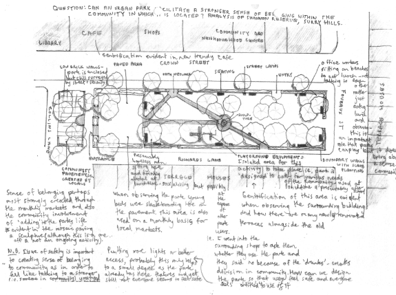
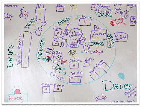
Behavioural map of Shannon Reserve, Surry Hills by author
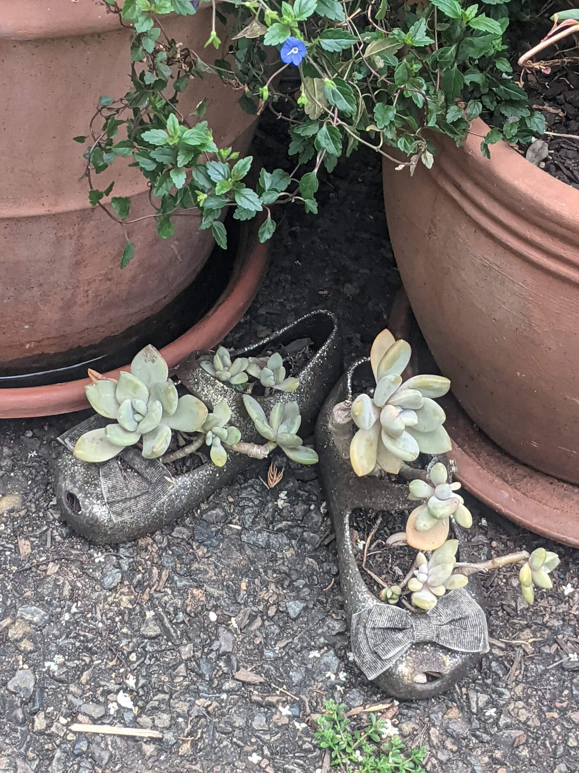
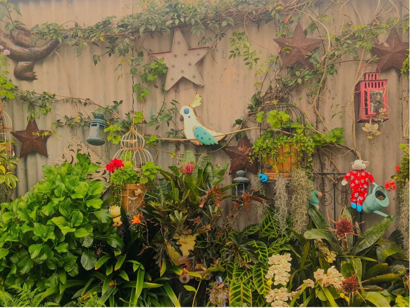
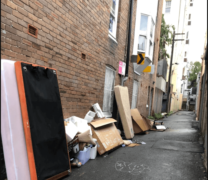
Naturalistic observation of the built environment using photographic documentation to uncover small everyday practices of care occurring in the laneways.
Small details....seemingly small and insignificant activities occurring in public spaces are often overlooked
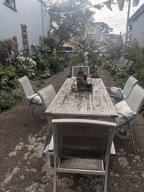
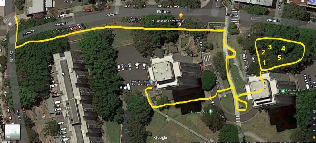
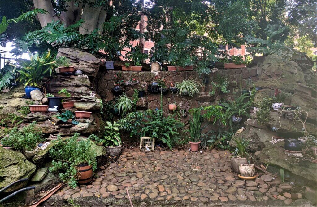
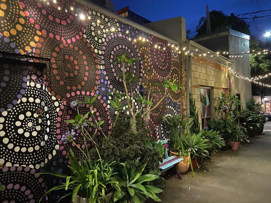
The 'Magic Lane' (Ferris Lane), Annandale on site visit 4.10.23 by author
Participant observation whereby I partake in various laneway activities and conduct the research as a collaborative process between myself and participants.
A chance encounter ...
at the 'Magic Lane' as I sat and ate lunch a resident, who was with her young grandson, started to engage in an informal conversation with me.
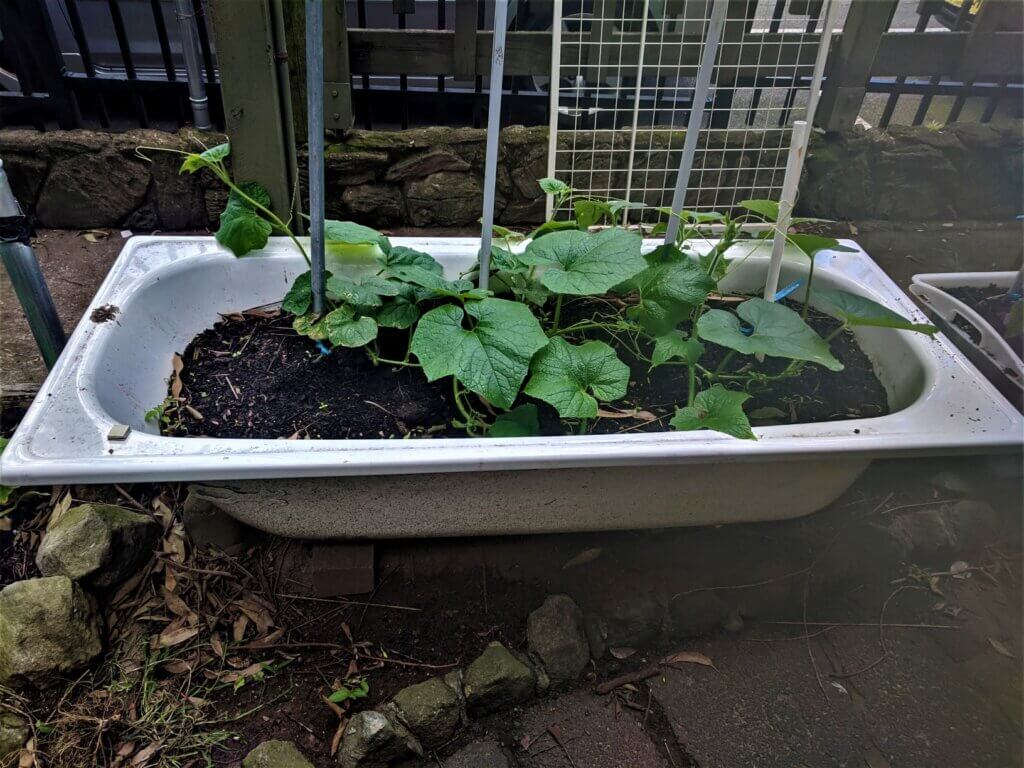
Seating at the 'Magic Lane' (Ferris Lane), Annandale on site visit 4.10.23 by author
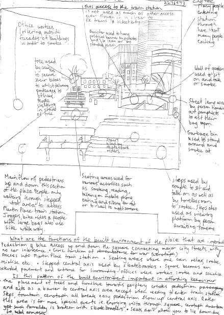
Behavioural and movement mapping using photos and site plans to understand the patterns and social order of diverse users of the laneways (behavioural maps) and how people and animals move through the laneways (movement maps). The maps will document these behaviours and movements at different times of the day and different days of the week.
Behavioural map of Martin Place, Sydney by author
Participatory social mapping workshops where participants will be asked to describe and document, through drawings and annotated text, the social relationships and networks that happen through the laneway practices.
Place is defined socially, not just physically.
In-depth interviews which will document the emotional reactions of participants who engage with the laneways and capture their narratives of spatial use.
- I will use photo elicitation during the interviews to help prompt the participants to talk about activities which they have engaged in within the laneways.
- Some of these in-depth interviews will be undertaken as 'go-alongs' that entail a walking interview between the researcher and participant to capture the material culture of the laneways as participants can engage and talk directly with the objects/plants/wildlife that constitute the laneways.
Example of
'go-alongs' or walking interviews
Photos of Marton Public Housing Tower Feb 2021 by author
Historical documentation will provide important information regarding a timeline of events occurring in the Sydney laneways and how residents have transformed the laneways over time.
Survey questionnaires aim to capture data about usage patterns and the demographic profile of the people engaging with the laneways. The surveys offer an alternative for people to contribute to the research but who do not wish to engage in in-depth interviews and workshops due to possible sensitivity regarding the legality of laneway practices.
I am in the beginning stages of my research and have done some preliminary site investigations to scope out potential laneway sites across inner Sydney. As I progress through the research I will post updates on this website making note of the pros and cons of using various place-based methods.